By Arthur Dominic J. Villasanta , | June 01, 2017
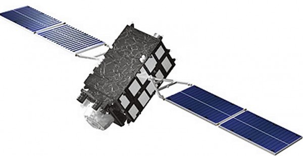
Michibiki-2.
Japan today successfully launched the second of four geolocation satellites, which together will create one of the most accurate GPS-like systems in the world.
The satellite "Michibiki-2" is the second of four satellites comprising the "Quasi-Zenith Satellite System (QZSS)," a four-satellite regional time transfer system. QZSS is also the satellite-based augmentation system for the Global Positioning System (GPS) receivable within Japan.
Like Us on Facebook
The first satellite, Michibiki-1, was launched in September 2010.
QZSS is a Japanese satellite navigation system operating from inclined, elliptical geosynchronous orbits to achieve optimal high-elevation visibility in urban canyons and mountainous areas. The navigation system's objective is to broadcast GPS-interoperable and augmentation signals, as well as original Japanese (QZSS) signals from a four-spacecraft constellation.
QZSS will improve the accuracy of car navigation systems and smartphone maps to only centimeters. It's targeted at mobile applications and provides communications-based services (video, audio and data) and positioning information.
An H-IIA rocket carrying Michibiki-2 lifted-off from the Tanegashima space center in southern Japan.
"The launch was a success," said a Cabinet Office spokeswoman.
The launch was part of a broader plan to build a domestic version of GPS with four satellites focusing on Japan. Michibiki-2 can also cover the Asia-Oceania region and is intended for civilian use.
"After we establish the four-satellite network, its use can expand into self-driving cars, agriculture, construction and other fields," said Yosuke Tsuruho, state minister in charge of space policy.
The third and fourth QZSS satellites are to be launched by March 2018. Japan plans to boost the number of QZSS satellites to seven by 2023.
JAXA is in charge of integrating the system as a whole, and cooperating with related research organizations to develop the High Accuracy Positioning Experiment System, the QZS Bus System and the Tracking Control System.
QZSS satellites are designed to operate for more than 10 years.


-
Use of Coronavirus Pandemic Drones Raises Privacy Concerns: Drones Spread Fear, Local Officials Say

-
Coronavirus Hampers The Delivery Of Lockheed Martin F-35 Stealth Fighters For 2020

-
Instagram Speeds Up Plans to Add Account Memorialization Feature Due to COVID-19 Deaths

-
NASA: Perseverance Plans to Bring 'Mars Rock' to Earth in 2031

-
600 Dead And 3,000 In The Hospital as Iranians Believed Drinking High-Concentrations of Alcohol Can Cure The Coronavirus

-
600 Dead And 3,000 In The Hospital as Iranians Believed Drinking High-Concentrations of Alcohol Can Cure The Coronavirus
-
COVID-19: Doctors, Nurses Use Virtual Reality to Learn New Skills in Treating Coronavirus Patients
